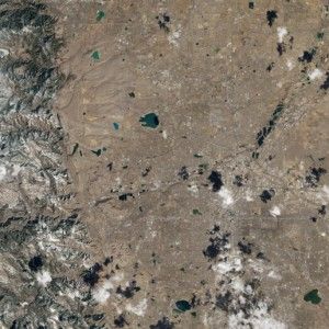
The Landsat Data Continuity Mission (LDCM) has send back images of Earth from both of its instruments—the Operational Land Imager (OLI) and the Thermal Infrared Sensor (TIRS). NASA has published an impressive satellite image tasked on 18 March 2013 which shows the Rocky Mountains and the cities Cheyenne, Fort Collins, Loveland, Longmont, Boulder and Denver.
The Natural color image (RGB – bands 4,3,2) is suitable for e.g. monitoring projects, mapping projects for large areas.
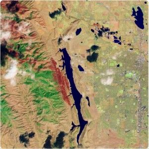
The False color image (G,NIR,SWIR – bands 3,5,7) is the result of the band combination of green, near infrared and short wave infrared 2. This satellite image can be used e.g. for mapping areas after a wildfire and for other classifications.